Pricing Details
Enterprise Solutions: Custom pricing based on the scope and scale of the project. Disclaimer: For the most accurate and current pricing details, refer to the official Cyvl.ai website.
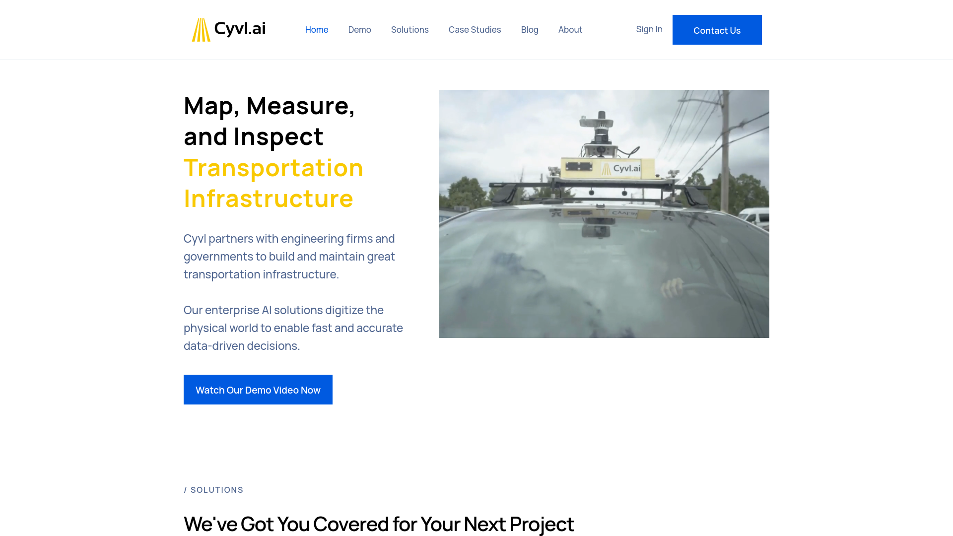
Product Visuals (1 images)
Strengths
- Time Efficiency: Accelerates field surveys by up to 50 times compared to traditional methods.
- Cost-Effective: Reduces the financial burden of extensive manual labor and speeds up the data collection process.
- Scalability: From small projects to extensive mapping efforts, Cyvl.ai's sensors adapt to various scales seamlessly.
- Data Accuracy: Enhances decision-making with high-precision data and detailed geospatial infrastructure reports.
Limitations
- Initial Setup Requirement: Requires initial installation of sensors and setup, which might be challenging for some users.
- Hardware Dependency: Reliant on specific hardware for data collection, which might limit flexibility in some scenarios.
- Learning Curve: New users may need some time to fully leverage the platform's capabilities.
What You Get
Key Features
- Automated Pavement Condition Assessments: Utilizes advanced algorithms to perform detailed pavement condition evaluations.
- 360° Streetview Imagery: Offers comprehensive street-level imagery for enhanced urban analysis and planning.
- LiDAR Scanning: Provides rapid 3D LiDAR scans of the built environment, significantly reducing the time required for data acquisition.
- Asset Detection: Capable of detecting a wide array of Right-of-Way (ROW) assets, such as streetlights, signs, and hydrants.
- Sign and Tree Inventories: Simplifies the process of inventorying traffic signs and managing urban forestry through sophisticated AI technology.
- ProsTime Efficiency: Accelerates field surveys by up to 50 times compared to traditional methods.Cost-Effective: Reduces the financial burden of extensive manual labor and speeds up the data collection process.Scalability: From small projects to extensive mapping efforts, Cyvl.ai's sensors adapt to various scales seamlessly.Data Accuracy: Enhances decision-making with high-precision data and detailed geospatial infrastructure reports.ConsInitial Setup Requirement: Requires initial installation of sensors and setup, which might be challenging for some users.Hardware Dependency: Reliant on specific hardware for data collection, which might limit flexibility in some scenarios.Learning Curve: New users may need some time to fully leverage the platform's capabilities.
Best For
- Engineering Firms: Trusted by industry leaders for comprehensive infrastructure analysis.
- Government Agencies: Employed by government bodies to oversee and upgrade transportation systems efficiently.
- Urban Planners: Used by planners for detailed urban and regional development projects.
- Environmental Consultants: Utilized for environmental impact assessments and sustainability studies.
- Uncommon Use Cases: Adopted by academic institutions for research purposes; utilized by emergency management agencies for disaster response planning.
Integrations
ArcGIS Integration: Seamlessly exports data into ArcGIS for further analysis. Civil 3D Compatibility: Works with Civil 3D to enhance civil engineering projects. Cartegraph Integration: Syncs with Cartegraph for asset management and maintenance. Cloud-Based Platform: Ensures easy access and collaboration via a cloud data processing platform.
Similar Tools

Weekly Issue
⚡
Research tools · weekly digest
The AI Weekly — free in your inbox
New AI tools, pricing changes, expert picks, and hidden gems — curated by Mr. Spark every week. Join 5,000+ readers who stay ahead of the AI curve.
No spam, ever
Unsubscribe anytime
100% free